High-Tech Planes, Supercomputers and Helitankers Help Fight Wildfires California
Fire crews abandon hand-drawn maps for up-to-date information on phones to track and extinguish blazes faster.
By Erin Allworth for The Wall Street Journal
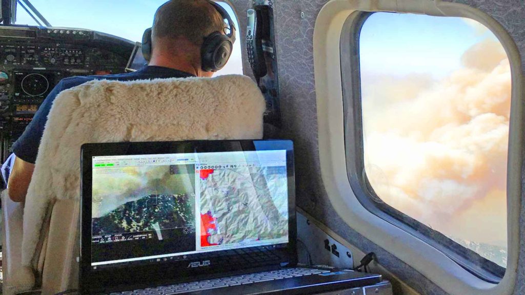
LOS PADRES NATIONAL FOREST, Calif.—Smoke from the Cave Fire billowed over Santa Barbara as Steve Gazdik sat in an infrared- and radar-equipped airplane flying above the 3,000-acre blaze.With the help of a camera on the plane’s nose, Mr. Gazdik zoomed in on the fire on his laptop computer, looking for still-burning embers via infrared. He then charted the fire’s edges,matching them to geographic features via Google Earth and transmitting the resulting information to decision makers on the ground.“It’s a geek’s delight, airborne,” said Mark Zaller, chief technology officer for Courtney Aviation,which operates the plane. The aircraft is part of a multi county program in Southern California backed by $4.5 million in state funds that is putting state-of-the-art technology to work fighting increasingly dangerous wildfires.The three-month-old program marks a big change for firefighting agencies whose tactics have traditionally been low-tech. They hope the new capabilities will help them rein in damage during California’s lengthening fire season by sending personnel to the right locations faster tocontrol or extinguish a blaze.“It gives us, as decision makers, an opportunity to take the limited number of resources that are coming in and focus them,” said Brian Fennessy, chief of the Orange County Fire Authority.The program, along with a wet winter and some favorable winds, has played a role in a fairly mild 2019 fire season. None of the more than 5,600 wildfires logged by Cal Fire, the state fire-protection agency, has caused mass casualties or damage like last year’s Camp Fire, which destroyed the town of Paradise and killed 85 people.
Read article on Wall Street Journal or Download .pdf of article here.